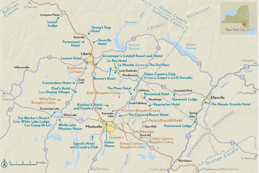
There once was a time in the not-so-distant past when dreams were realized and memories are savored. To those of the Jewish faith who were fortunate to have lived during its heyday and golden years, it was referred to as the Borscht Belt, or the Jewish Alps.
If you followed the yellow brick road out of Brooklyn or Bronx and up old Rt. 17 you would come upon an oasis of delight. Your anticipation was enhanced by the periodic signs giving you the distance to this destination. You came around the bend and down the hill and there it was a majestic building crowned by a humungous apple and you knew you had arrived at the Red Apple Rest, the landmark which designated the halfway point on your way to a summer paradise. We had to stop in both directions. It was religious!

I remember running up to the outdoor counter to get a delicious hotdog, using the wood dowel to smear mustard on the puppy, and using the large fork to crown it with a proper amount of sauerkraut. Add a cold beverage and life was good! Mmm good!
We were off after satisfying our natural needs and savoring the nourishment we consumed. We were heading northwest.
Now for you geography mavins this map below designates what we consider the Borscht Belt. The primary area was in Sullivan County (Solomon County to some) and a portion of Ulster County, NY.
Arguably the capital was Monticello, NY although Ellenville and Liberty might disagree they would have a losing position. I will defend this fact later on.
We have arrived!


